
Where and What is Baja California?
I never expected Baja California to be so beautiful. And I didn't understand what “Baja California” or “Baja California Sur” was before visiting the area, just south of San Diego. What was this peninsula extending downward from California that was home to so many cities I've heard about but never visited?
After visiting, and having a bit of an educational update from Dan, who used to live in San Diego (just a hop, skip and a jump from Tijuana, Mexico) I realized Mexico was divided into its mainland and the Baja California Peninsula on the west. Sort of like how there's the Yucatan Peninsula that's part of Mexico on the east coast.
“Baja” Literally Means “Low” in Spanish
It's the lower region of California, which extends northward into the United States. Mexicans consider America's California (and beyond into additional states), “Alta California,” which literally means “high.” Here's the down and dirty of the region:
- Baja California is bordered by the Pacific Ocean to the west and Sea of Cortez to the east (aka Gulf of California)
- The name “California” is derived from, “Las Sergas de Esplandián” (The Adventures of Esplandián), an early 16-century novel which featured a mythical island whose ruler was named, Queen Calafia. When Spanish explorers found this region later in the century they believe it was an island, thus naming it California after the novel.
- It's the second-longest peninsula on earth
- The Tijuana border is one of the most (if not the most) crossed international borders in the world
- Notable cities include Tijuana, Rosarito, Cabo San Lucas, Tecate (yes, like the beer!), and Valle de Guadalupe (see map below!)
Cultural Center of Tijuana
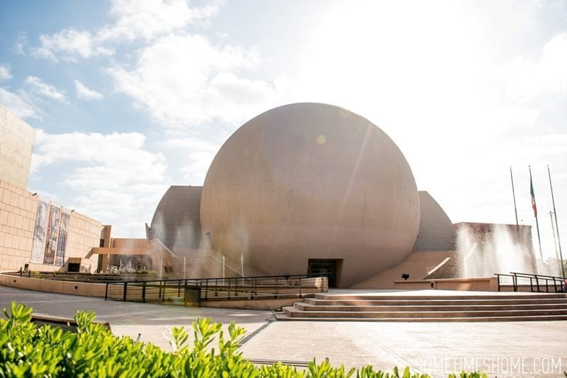
When we arrived in Tijuana, just minutes from the border to the United States and north of Rosarito Beach, our first stop was the Centro Cultural Tijuana, or the Cultural Center of Tijuana. Isn't it gorgeous? We stopped here to learn a bit about the region and its many talented artists (there's a lot of art inside!).
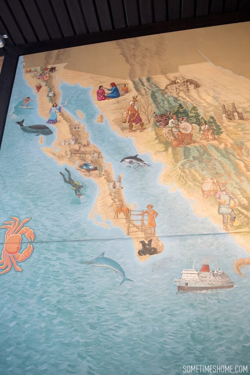
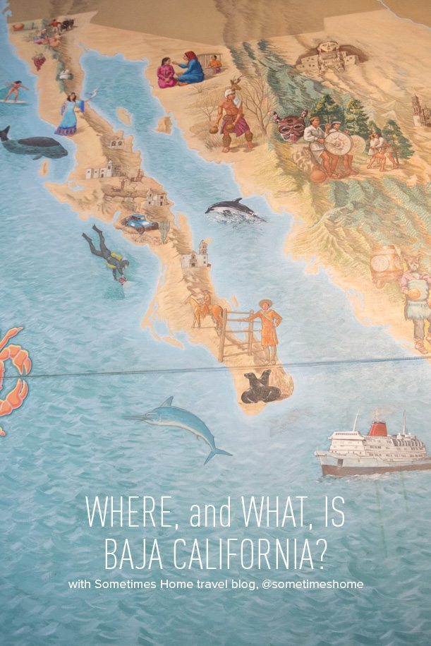
For a little geographical placing (because as I said, geography isn't my strong suit though I'm great with visuals) I was happy to see a painted mural inside the center that our tour guide, Fernando, was able to explain to me and give me a crash-course in the region's history.
Putting Baja California on a Map
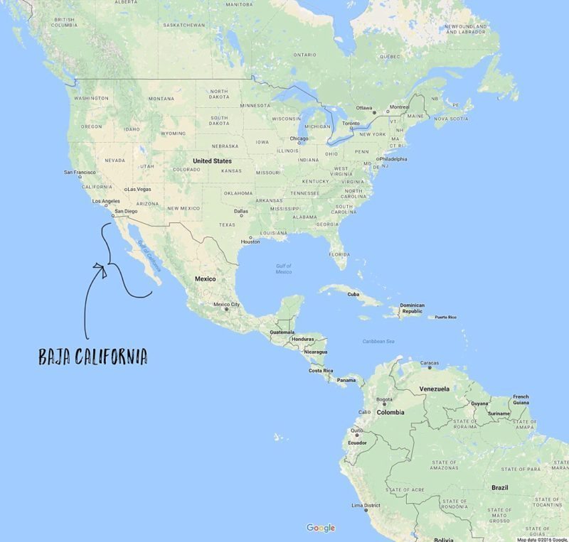
Let's mark this puppy with the help of Google maps and my Photoshop skills. I've added two images below:
- The first is to give you a general placement of the area within the Americas
- The second to zoom in a bit closer and note some key cities of the region.
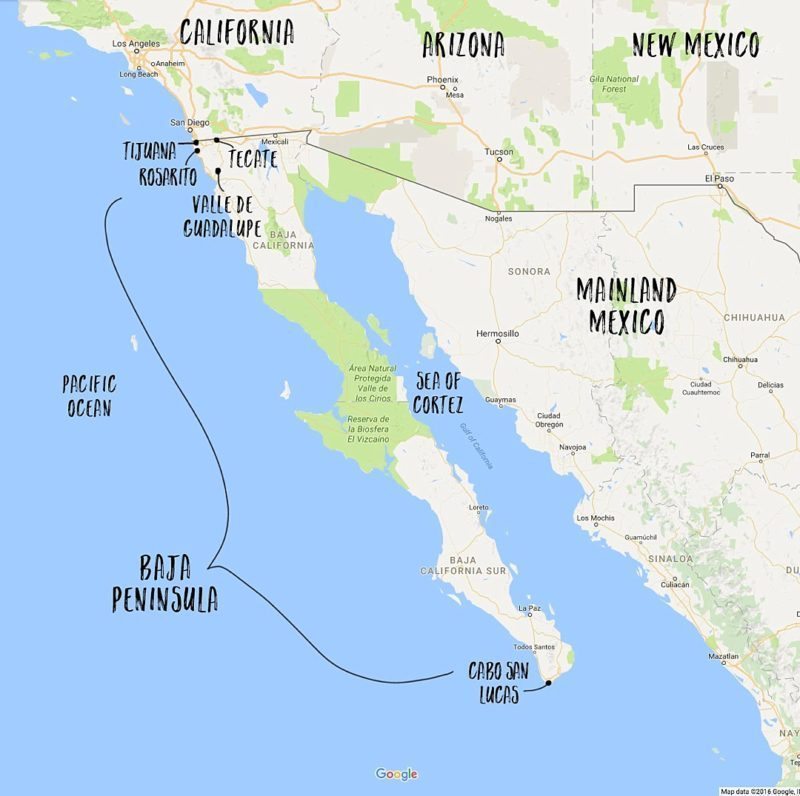
I visited Cabo San Lucas not too long ago and didn't even realize it was the southernmost point of the Baja Peninsula. Now I know!
Preserving the Land of the Baja Peninsula and Its History
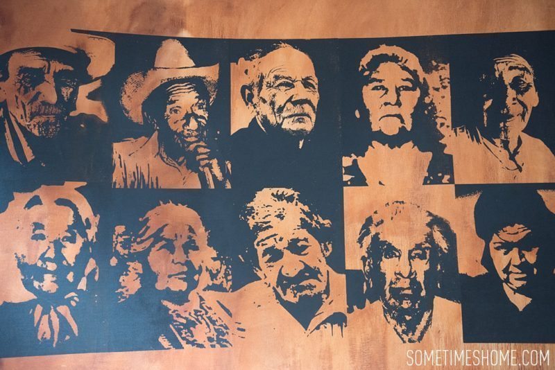
One of the art pieces I loved inside the Cultural Center was this positive/negative space wall with portraits of people of the region. The images are so bold and expressive and the piece really gives you a taste for personalities that make the region great.
During the 1980's the Mexican President's wife placed importance on funding a museum that would ensure the history of this area didn't die since there wasn't much written about it in the history books. The center opened in 1982 with the purpose of educating the Mexican people about the area and ensuring its history would live on. Overall, the center's very attractive and worth a visit for its architecture and fountain, alone but its interesting architecture and educational contents seal the deal.
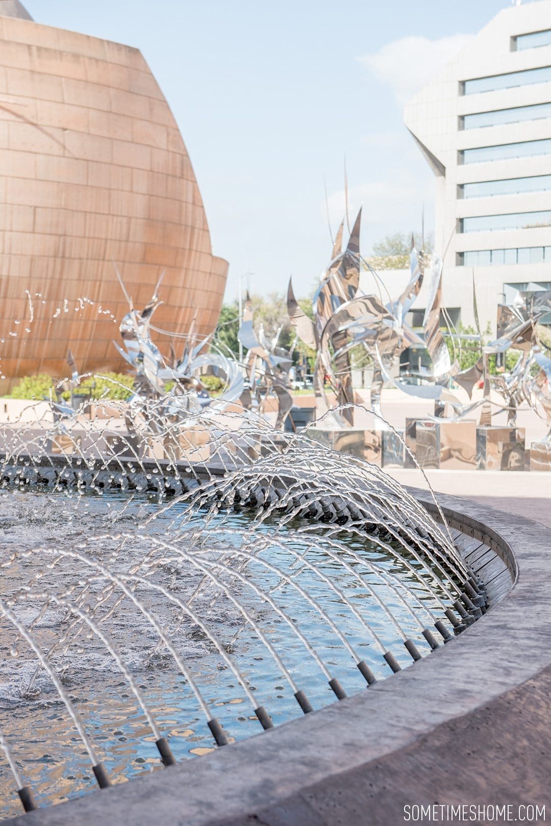
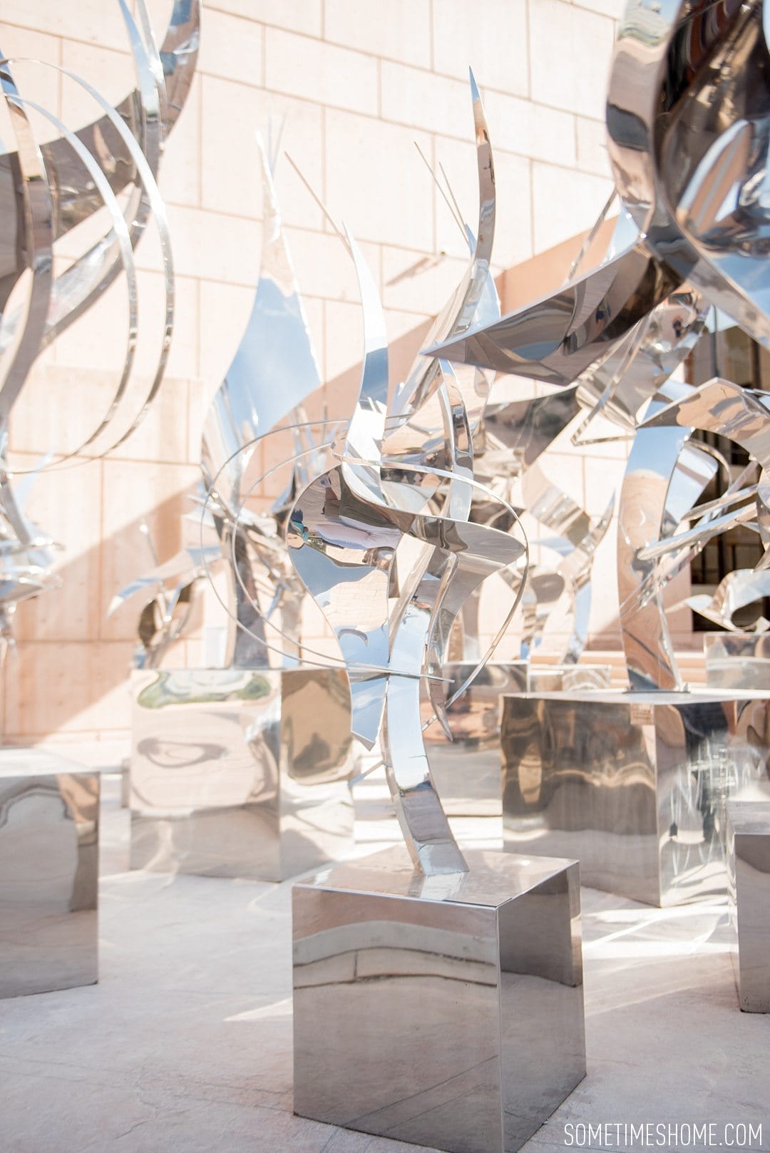
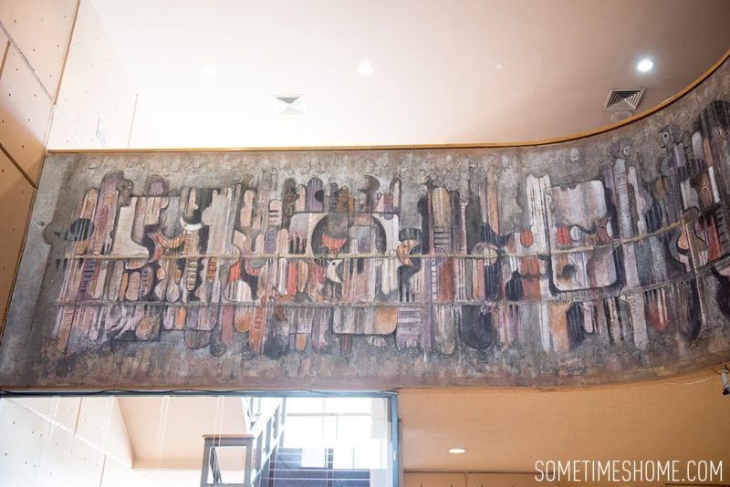
The sculptures above were a temporary exterior exhibit by artist Leonardo Nierman called, “Espejismos.” Another artist created the painting below inside the theater lobby with chalk. Its desert earth tones palette help tell the story of the creation of California.
California isn't just the United States portion as many understand – the peninsula extends into Mexico spanning two countries.
For more west coast inspiration check out:
- Food Trucks in Tijuana: Telefonica Gastro Park
- 5 Things to do in Rosarito Mexico
- Our 12 Favorite Spots Around San Diego, California
Have you ever visited a region that surprised you?
I’ve actually been places I didn’t even know I’ve been. Folks go to describe someplace to me and the wife has to remind me, we’ve been there. Especially places semi nearby like in northern California, so many towns. Same thing happens in Mexico as we’re right by the border. I never know where I am.
Haha I love that! Katherine is your memory. 🙂